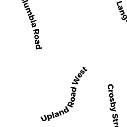
26 UPLAND RD WEST
Owner Information
DEYST JOHN J JR & MARY A/ TRS
26 UPLAND RD WEST
ARLINGTON, MA 02474


Property Details
26 UPLAND RD WEST is classified as a Single Family Residential (Colonial).
The primary structure on this property was built in 1910. There are 2,892ft2 of built area within this property. There is 2,892ft2 of residential/living space within this property. This property is listed as having 7 rooms.
26 UPLAND RD WEST is valued at $1,505,400. The land is valued at $822,300 and the structures are valued at $678,700. There is an additional valuation of $4,400 on this property.
This property is in Zone R0. Confirm with local Zoning Board authorities to ensure there are no overlays or other easements on this property.
The most recent deed for 26 UPLAND RD WEST is recorded at the local registrar in Book 69469, Page 538. 26 UPLAND RD WEST was last sold on Wednesday, June 21, 2017 for $99.
Assessment data from fiscal year 2022.
Flood Data
According to the FEMA National Flood Hazard Layer, this property does not appear to be in a flood zone. It may also be in an area not yet reviewed. Nonetheless, confirm this information prior to taking any action.
To view the flood hazards around this property, create a FEMA "Firmette" Map of the area around 26 UPLAND RD WEST.
Broadband Internet Providers
| Provider | Type | Bandwidth (mbps) | |
|---|---|---|---|
| Viasat Inc | Satellite | 100 | 3 |
| VSAT Systems, LLC. | Satellite | 2 | 1 |
| RCN | Cable | 500 | 20 |
| Starry, Inc. | Fixed Wireless | 200 | 200 |
| HughesNet | Satellite | 25 | 3 |
| Comcast | Cable | 1000 | 35 |
| Verizon New England Inc. | Fiber | 940 | 880 |
| GCI Communication Corp. | Satellite | 0 | 0 |
Broadband service provider data from December 2020.
Adjacent Properties
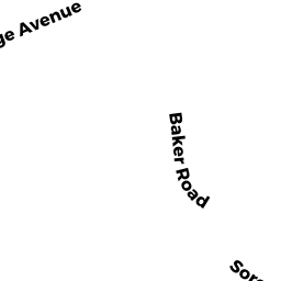
- 63 COLLEGE AVE
Single Family Residential owned by MOSKOFIDES MARYANN - 12 UPLAND RD WEST
Single Family Residential owned by ANDERSON KRISTIN - 148 CROSBY ST
Single Family Residential owned by WIDRICK JEFFREY J & - 144 CROSBY ST
Single Family Residential owned by VERGITH PAULA C/ TRUSTEE - 55 COLLEGE AVE
Single Family Residential owned by TAMBASCO CHRISTOPHER R& KASSI - 59 COLLEGE AVE
Single Family Residential owned by YU CHIHYI &